 Welcome to the fourth installment in Joey’s Unofficial RubyFringe Guide to Toronto, a series of offbeat articles to acquaint attendees of the upcoming RubyFringe conference with Accordion City.
There’ve been three articles in the series so far:
When I visit a city that’s new to me, I try to get a sense of “the lay of the land”. What sort of areas are around where I’m staying? Which zones come alive at what times of the day? If I started walking in this direction, what sort of neighbourhood would I end up in? Where can I see some interesting stuff, and where will I end up running into something I could easily get at home? These are the sorts of questions that I’ll try to answer for Toronto in these “Lay of the Land” articles. In this article, I’ll look at what’s within a couple of blocks of the conference hotel.
What’s Near the Conference Hotel?
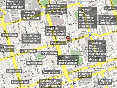
The map below covers the area that’s within about a ten-minute walk of RubyFringe’s conference hotel, the Metropolitan Toronto. The Metropolitan is represented by the red marker with the letter “A” (it’s very Hester Prynne, isnt it?). I’ve added some annotations to give you a general idea of the sorts of neighbourhoods that surround the Metropolitan.
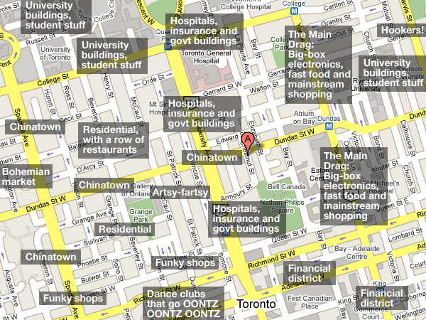
A City of Neighbourhoods, A Pocket of Boring
Accordion City can best be described as a city of neighbourhoods put together like a patchwork quilt, each patch having its own character and offerings. This is good news: it makes life pretty interesting for the locals, and it should be doubly so if you’re visiting.
There’s bad news, I’m afraid: the neighbourhood in which the Metropolitan is located is a pocket of boring. How boring? So boring that this is the most interesting view on the street where the hotel is located:
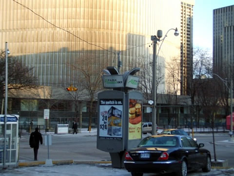
The curved backside of New City Hall, as seen from a few paces south of the hotel.
Yup, the immediate area is that boring.
It’s a zone of nondescript office and hospital buildings surrounding Dundas Street, which used to be downtown Chinatown’s main drag back in the 1970s when I was a slip of a lad.
(I say downtown Chinatown because we’ve got three Chinatowns here. I’ll elaborate in a later article.)
Downtown Chinatown moved west towards Spadina Avenue, and the offices rushed in to fill the void. There are still remnants of the old Chinatown that still dot this part of Dundas, but for the real Chinatown action — the restaurants, the shops, the lively street stalls that will gladly sell you a big-ass, smelly-as-ass durian, the “holy crap, Blade Runner came true” Chinatown, you’ll have to walk about ten minutes westward.
The Metropolitan Hotel and Chinese Food
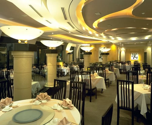
Lai Wah Heen Restaurant.
The Metropolitan Hotel is the biggest testament to the fact that the area was once the heart of downtown Chinatown. Most hotels in North America have a primary restaurant that serves your generic “North American” cuisine; the Metropolitan’s all about the Chinese food. Their main dining room, Lai Wah Heen, is a Chinese restaurant that serves some very good food — so good that it’s one of the few hotel restaurants where you’ll see at least as many locals as guests. I’ve been to a Chinese wedding reception in this hotel and it was some of the best wedding reception food I’ve tasted. I’m looking forward to the dim sum conference lunch scheduled for Sunday, July 20th.
Across the street from the Metropolitan is a building that looks like a hotel, but missing the hotel markings. That’s because it used to be the Colonnade Hotel, which used to be the Chinese hotel until the Metropolitan took over (it’s deVilla family tradition to have Chinese food for our wedding rehearsal dinners, and my sister’s was there). It’s now a University of Toronto student residence.
Just East of the Hotel – Yonge and Dundas: The Seething Pit of the Main Drag
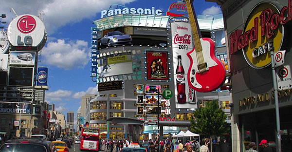
Yonge Street, looking north towards the corner of Yonge and Dundas.
Yonge Street (pronounced “young”) is the city’s main north-south street; it divides Accordion City into its east and west halves. The corner of Yonge and Dundas — a very short walk east of the Metropolitan — is pretty much in the geographic centre of the downtown core. You should think of it as the local equivalent of New York City’s Times Square: major retail shopping, “grey market” electronics stores, billboards and lights, bored teenagers, tourists and pizza, pizza, pizza.
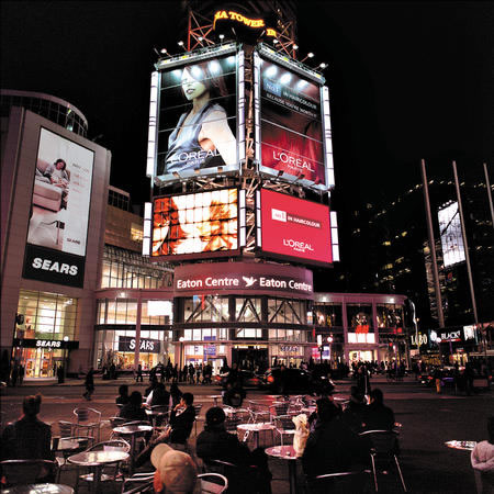
The Eaton Centre, as seen from across the street.
I’ve been to nerd conferences where I’ve wished that there was a computer store handy because I needed something like a cable or a USB key. That’s not going to be a problem at RubyFringe, as there’s both a Best Buy on the southwest corner of Yonge and Dundas and a Future Shop (a Canadian electronics/computer big-box store) on the northeast corner.
(There’s a far more interesting electronics store — Active Surplus — not too far from the hotel. I’ll cover it in a later article.)
If you go south on Yonge, you’ll hit the Eaton Centre, the major downtown shopping mall. It’s got the sort of shops you’d expect at a mall; the only surprise for American visitors is that Sears in Canada isn’t as ghetto as it is in the U.S. (that’s because Sears in Canada took over the Eaton’s chain of department stores after they went under).
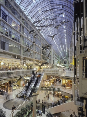
Interior of the Eaton Centre.
It’s tempting to dismiss the Eaton Centre as just another shopping mall, but for a lot of Torontonians, it’s also one of the most-used and useful pedestrian routes in town. Spanning the distance between two subway stations on Toronto’s busiest line, the mall remains open even after its stores are closed (it closes when the subway closes), making it effectively a covered sidewalk for Yonge Street between Dundas and Queen Streets. (Urban planning nerds should see this article for more.)
Just South of the Hotel: Nathan Phillips Square: Wasn’t it Blown Up in Resident Evil 2?
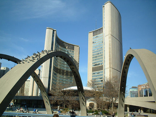
Toronto’s City Hall.
You may have seen Toronto’s City Hall in Resident Evil 2, or perhaps you caught a glimpse of it in either the original series or Next Generation version of Star Trek. It’s architect Viljo Revell’s modernist masterpiece and one of the more distinctive features of our city. It’s worth the short walk over from the hotel, and if you’re into taking pictures, it makes a pretty good subject.
If you walk into City Hall’s lobby and turn to the right, you’ll see this:
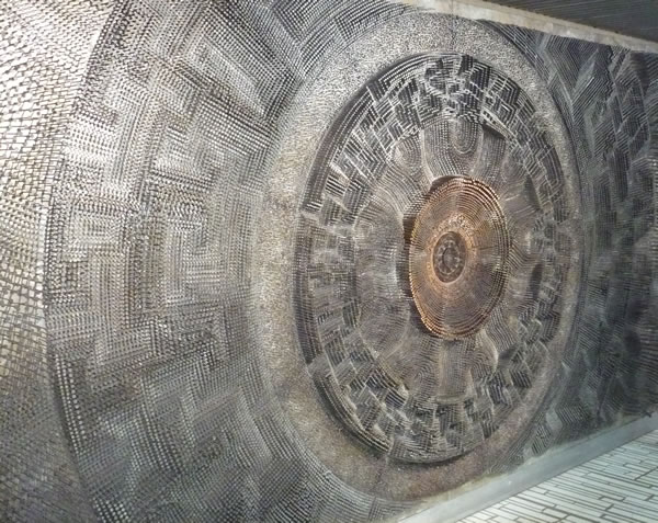
It’s a wall mural made of thousands of nails. There’s a local tradition: take a penny and drop it into the mural, among the larger nails on the left or right side of the mural. It’s descend, pachinko-like, making a musical noise along the way. Here’s a video:
Just North of the Hotel: Nothing, Really
Well, I wouldn’t say nothing — there are a number of hospital buildings, including some world-class institutions of healing like “Sick Kids” (a.k.a. the Hospital for Sick Children, where Pablum was invented) and the Peter Munk Cardiac Centre.
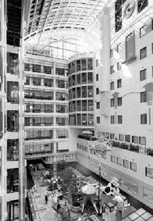
The atrium at Sick Kids.
If you’re an architecture nerd, you might find a visit to the atrium of Sick Kids worth a visit — it’s so bright and airy that it’s easy to forget that you’re in a hospital. Having said that, my guess is that the last place you want to end up during your visit to Toronto is a hospital.
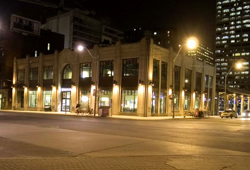
Toronto Bus Terminal.
The other place just north of the hotel is the Toronto Bus Terminal. It’s nowhere near as scuzzy as a lot of other big city bus terminals, but the usual parade of off-their-rockers and off-their-meds are often milling about.
Just this evening, while the Ginger Ninja and I were walking past the station, a large woman in a motorized wheelchair started a conversation with us.
“I gotta go to the hospital tomorrow,” she said, as she took a sip from her large frappucino. “I got the diabetes.”
“Sorry to hear that,” we said.
“It’s not funny! I’m goin’ fuckin’ blind from the goddamn diabetes!” She took another sip and poured on the speed, disappearing down the street to stew in her own juices, which I assume are made of high-fructose corn syrup and bad life choices.
There are a couple of conveniences to the north: a Starbucks and a convenience store, both at the corner of Dundas and Elizabeth, a block away from the hotel.
Next Time…
I’ll cover what’s west of the hotel, which is where things get interesting. For starters, there’s this:
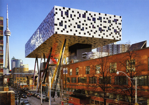
OCAD’s Sharp Centre Building.
One reply on “RubyFringe Guide: The Lay of the Land, Part 1”
[…] The Lay of the Land, Part 1 […]